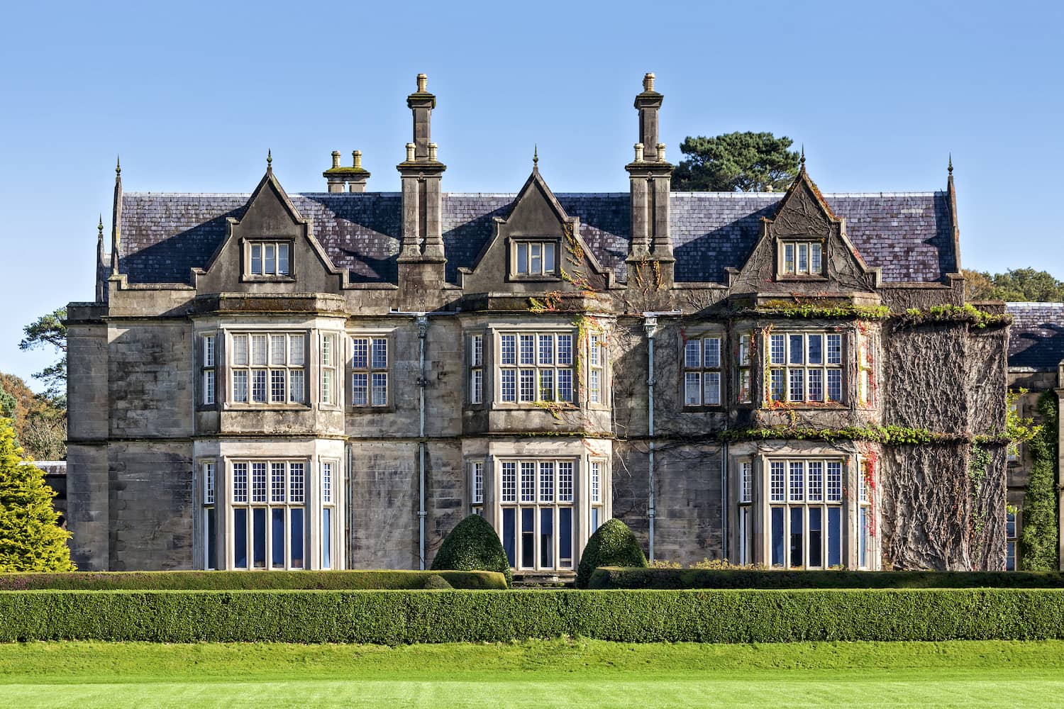
Muckross House
A 19th-century Victorian mansion located within Killarney National Park, featuring preserved gardens and traditional farm settings.
Visit the gardens early to avoid crowds near the main entrance.
The Ring of Kerry is a 179-kilometre scenic route encircling the Iveragh Peninsula in County Kerry, accessible year-round as a public road. This guide covers route logistics, traffic patterns, and the geographic context that shapes your journey along Ireland's southwestern coast.
Quick answer
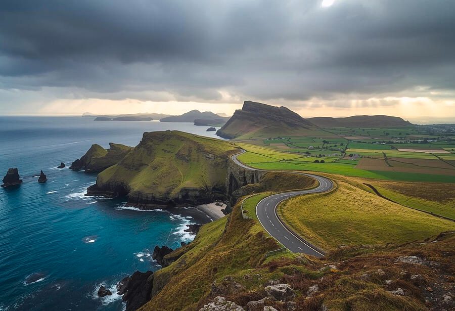
The Ring of Kerry is a free-to-access public road route circling the Iveragh Peninsula in County Kerry, Ireland, open 24 hours daily throughout the year. Starting between 07:00 and 10:00 helps you avoid the heaviest tour bus traffic on narrow coastal sections. The full loop covers approximately 179 kilometres and typically requires 3.5 to 4 hours of driving time without stops, though most visitors allocate a full day to include viewpoints and villages.
Tour buses follow a strict anticlockwise convention on the Ring of Kerry, a pattern born from road width rather than regulation. The route's narrowest stretches—particularly between Kenmare and Sneem—cannot accommodate two large coaches passing simultaneously, so operators agreed decades ago to travel in one direction. Private cars face no such restriction, but choosing the clockwise direction between 11:00 and 15:00 means meeting an unbroken stream of coaches on blind corners. The Iveragh Peninsula's geography determines the route's character. Departing Killarney, the N70 and N71 roads trace a coastal path that alternates between sea-level harbour towns and mountain passes crossing the Macgillycuddy's Reeks range. Elevation shifts are constant: the route climbs from Kenmare Bay to 240 metres at Moll's Gap, drops to Cahersiveen at sea level, then rises again past Kells Bay. Each transition delivers a distinct landscape—oak woodlands near Killarney, open bogland on the western peninsula, and rocky Atlantic shoreline approaching Waterville. Ring of Kerry information sources often emphasise the scenic diversity, but the practical implication is that driving pace varies significantly by segment. The peninsula's fifteen named stops include working towns, not constructed attractions. Sneem's village square, Portmagee's harbour, and Cahersiveen's heritage centre operate independently of the touring route—they existed as fishing and farming communities long before the scenic drive gained international recognition. This distinction matters when planning stops: shops and cafés follow local business hours rather than tourist season schedules, and many close on Sundays outside summer months. The route passes Valentia Island via a bridge connection and skirts Dingle Bay's southern shore, where visibility depends entirely on Atlantic weather systems that sweep inland without warning. Starting in Killarney remains the most common approach due to accommodation density, though Kenmare offers a southern entry point with less morning congestion. Either direction, completing the Ring of Kerry information gathering in advance—road conditions, weather forecasts, and stop selections—determines whether the day unfolds as a scenic commute or a series of timed sprints between coach convoys. The route's appeal lies in its accessibility: no tickets, no gates, and no designated start line, just a public road through one of Ireland's most continuously inhabited coastal landscapes.
“The route's narrowest stretches cannot accommodate two large coaches passing simultaneously, so operators agreed decades ago to travel in one direction.”
The optimal period to explore the Iveragh Peninsula is during the early morning arrival window of 07:00–10:00. Departing within this timeframe allows travelers to navigate the narrow roads before the heaviest volume of large tour buses begins.
Mild with temperatures 12°C to 17°C
These shoulder months offer a balance of manageable visitor numbers and fair conditions. Outdoor visibility remains high for coastal driving.
Warm with temperatures 15°C to 20°C
Peak tourism levels occur during these months. Expect increased road congestion throughout the day.
—
Starting your journey before 10:00 provides a significant advantage on narrow road sections. This timing avoids the primary congestion generated by organized coach tours.
Verdict: The best time to visit is during May or September, specifically arriving between 07:00–10:00 on weekdays to ensure the most efficient travel experience.
The Ring of Kerry is a public road route located on the Iveragh Peninsula in County Kerry, Ireland, and remains accessible to travelers at all times.
The Ring of Kerry is located on the Iveragh Peninsula in County Kerry, Ireland. Visitors traveling from Cork typically access the route via the N22 road toward Killarney, which serves as the primary gateway to the circuit.
N22 from Cork to Killarney
Bus Éireann route 245 from Cork to Killarney
Irish Rail Cork to Killarney via Mallow
The best arrival window is 07:00–10:00. Starting early allows visitors to navigate the narrow roads of the Iveragh Peninsula before the arrival of heavy tour bus traffic.
This clockwise loop suits travelers departing early from Killarney or Kenmare, covering roughly 180 km over 6–8 hours of driving plus stops. The route follows narrow coastal and mountain roads, so allow extra time during summer peak season.
Drive 20 km west through Killarney National Park, stopping briefly at Ladies View for lake panoramas. Arrive Killorglin for a quick coffee and restroom break before the coastal leg.
Follow the coast through Glenbeigh and Kells Bay, pausing at Rossbeigh Strand for a 15-minute beach walk. Continue to Cahersiveen, the largest town mid-route, for fuel and lunch supplies.
Pass Ballycarbery Castle ruins (10-minute photo stop) and climb toward Coomakista Pass for Atlantic views. Waterville offers waterfront picnic spots and public toilets.
Traverse the narrow mountain pass with layby viewpoints, then descend into Sneem village. Walk the colorful village square (20 minutes) and visit craft shops.
Complete the loop through Kenmare (optional stop for artisan shops) or continue directly back to Killarney. Roads widen after Sneem, easing the final stretch.
The Iveragh Peninsula offers several significant landmarks that provide insight into the geography and history of County Kerry. These locations represent the primary points of interest along the route.
A 19th-century Victorian mansion located within Killarney National Park, featuring preserved gardens and traditional farm settings.
Visit the gardens early to avoid crowds near the main entrance.
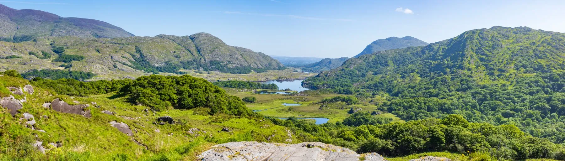
This scenic point offers views across the Upper Lake and the surrounding mountains of Killarney.
Stand on the viewing platform to capture the valley panorama.
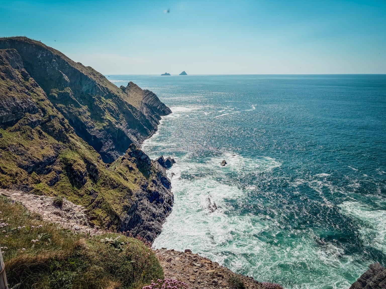
A coastal detour that provides views of the Skellig Islands, famous for their early Christian monastic ruins.
Drive this section slowly to observe the changing coastal cliff formations.
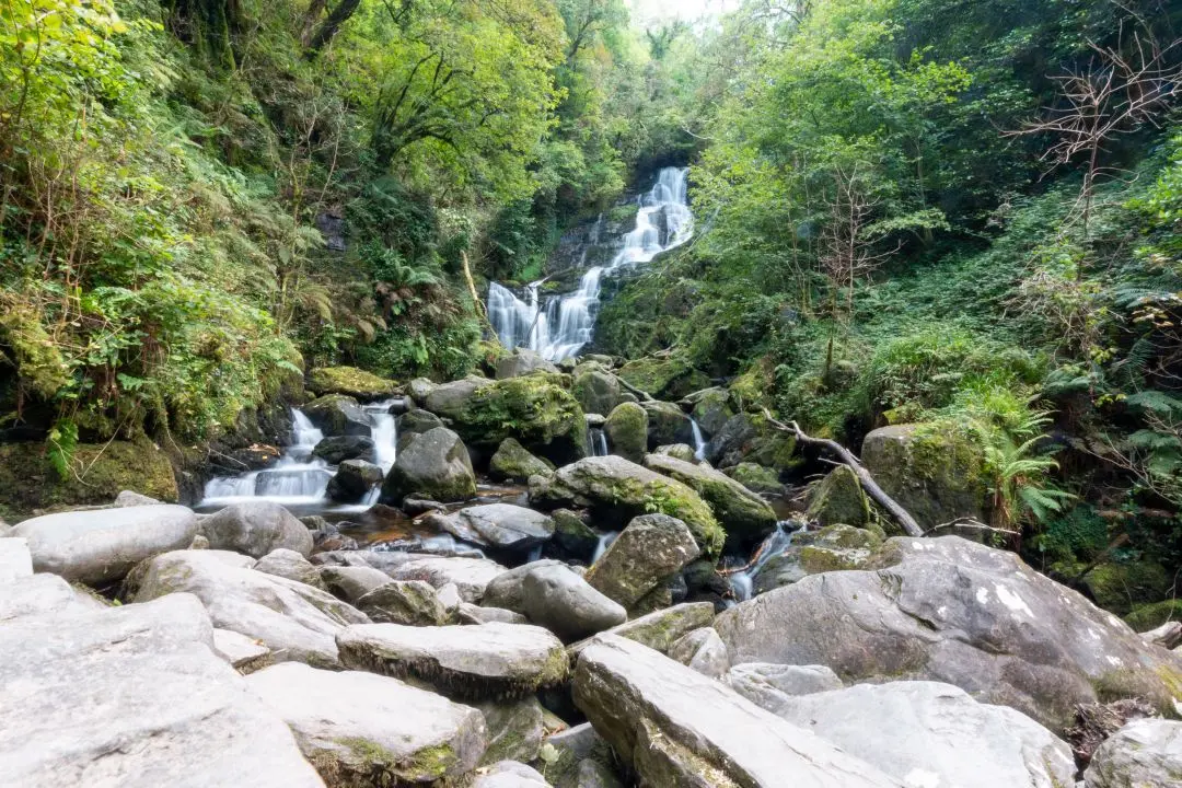
A 20-meter high cascade located at the base of Torc Mountain, accessible via a short woodland walk.
Walk the path to the upper level for a clearer perspective.
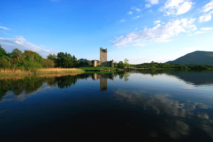
A 15th-century tower house situated on the edge of Lough Leane, built by the O'Donoghue Ross clan.
Look toward the water to see the castle reflected in the lake.
Prepare for variable weather, narrow roads, and limited services along the 179 km coastal route.
Everything you need to know about ring of kerry information
You can find comprehensive ring of kerry information by consulting official tourism portals or travel planning sites dedicated to the Southwest of Ireland. These resources provide logistical support for navigating the coastal road. Always verify that your ring of kerry information is current before departing from Cork.
The Ring of Kerry is a public road route, meaning there is no entrance fee. You can enjoy the scenery along the Iveragh Peninsula without purchasing tickets.
To avoid heavy traffic from tour buses on the narrow roads, the best arrival window is between 07:00 and 10:00. Arriving early ensures a more relaxed experience as you traverse the rugged Atlantic coastline.
The route is a public road network accessible at all times, with opening hours listed as Monday through Sunday, 00:00–23:59. This continuous access allows for flexibility in your travel schedule.
While the public road is free, taking a guided excursion provides historical context and professional navigation through the narrow mountain passes. Opting for a structured experience removes the stress of driving and allows you to focus on the landmarks.
The roads can be quite narrow with sharp turns and steep gradients, so caution is advised for all drivers. Using official ring of kerry information helps in understanding local traffic patterns and potential congestion spots.
Local visitor centers and digital brochures offer detailed maps highlighting key landmarks like Killarney National Park and various cliffside viewpoints. These guides are essential for planning your journey across the peninsula.